The port is located at the north of Beaulieu’s tip and s easy to access, although it is hardly visible at sea.
But when you will see the old city of Eze after Cap-Ferrat, you will not be far from the anchorage.
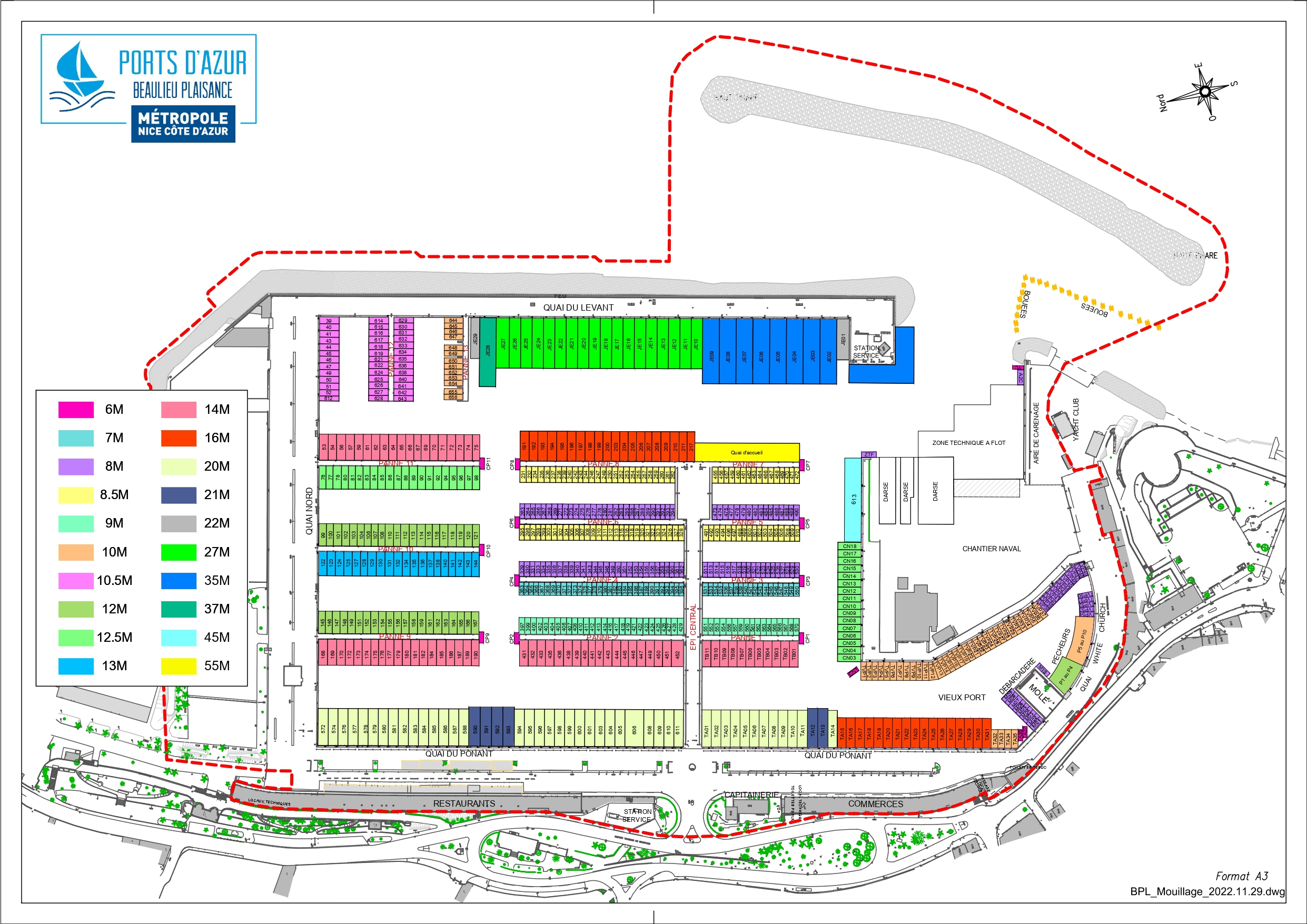
Download The Port’s map
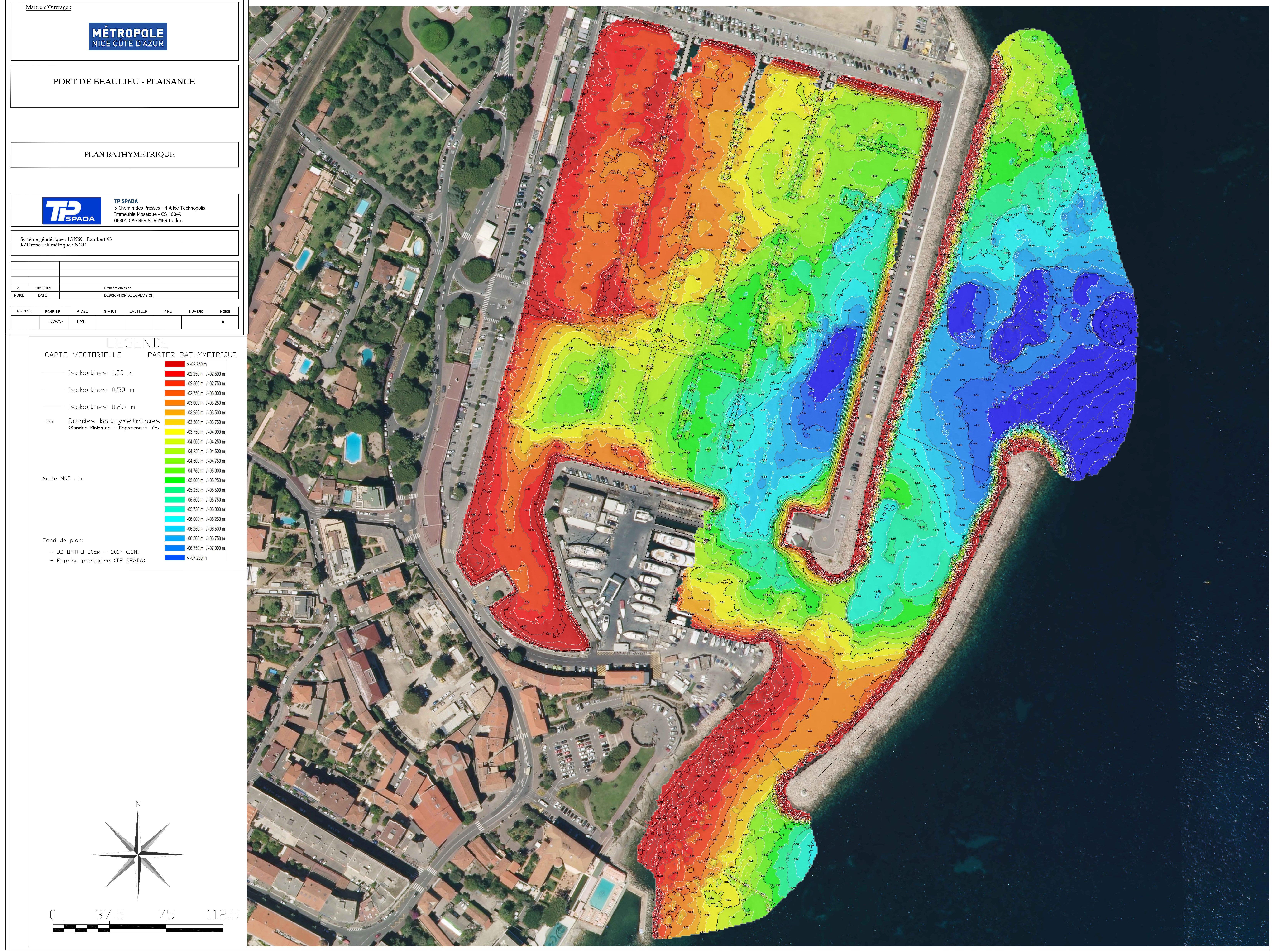
Download Bathymetric survey
The approach
Approach by day : the port, barely visible from the wide, is easily accessible and can be reached via two channels.
- South channel : for low-draft boats (<3m), boats up to 18m. The channel is marked by lights
- North Channel : must be used imperatively at night and when the sea is rough
- Dangers : rip-raps are hardly visible to the west of the great cliffs of Eze.
- 3 knots speed limit.
The port
Port access : to the north by the main channel – clear approach, sheltered from east- and western winds.
Distance: Saint-Jean-Cap-Ferrat 3M – Cap d’Ail 7M – San Remo (ITA) 20M – Calvi 91M
Maps: SHOM 6863-7017 / Navicarte 500
Description : 719 posts